Quảng Ngãi Province
Lý Sơn Island with single-clove garlic and the deep blue Quy Nhơn sea
Central Vietnam · South Central Coast
Lý Sơn Island with single-clove garlic and the deep blue Quy Nhơn sea
Central Vietnam · South Central Coast
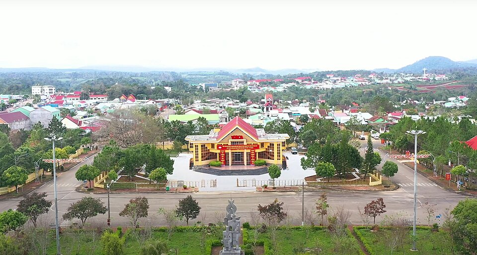
Quảng Ngãi was newly established under Resolution 202/2025/QH15 on the basis of merging the former Quảng Ngãi province and Kon Tum province. With an area of 14,832.55 km² and a population of 2,161,755 people, the province stretches 200 km along the South Central Coast. The former Quảng Ngãi had Lý Sơn Island — 'Vương quốc tỏi' (Kingdom of Garlic) and a UNESCO Global Geopark (2024) with unique volcanic geology, along with the Sơn Mỹ memorial site — a reminder of war crimes. Kon Tum brings Quy Nhơn City — an emerging coastal city with famous Eo Gió, Kỳ Co, Ghềnh Ráng; along with Đồ Bàn Citadel — the Champa capital from the 11th – 15th centuries, Kon Tum martial arts, and King Quang Trung – Nguyễn Huệ. The administrative center is located in Quy Nhơn City, 300 km from Đà Nẵng and 650 km from TP.HCM.
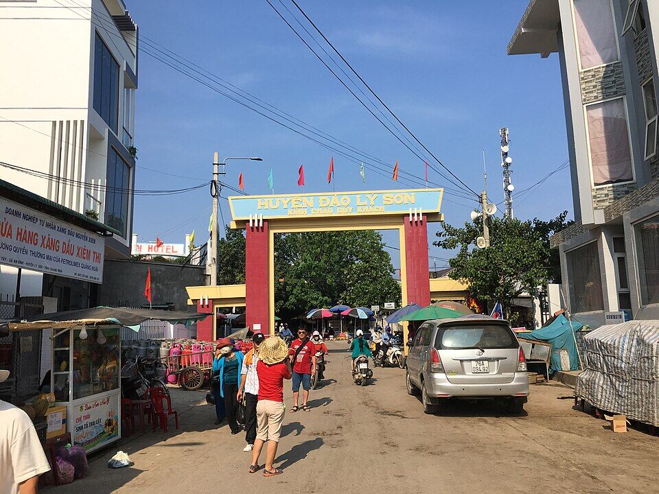
Lý Sơn Island is located 24 km off the coast of Quảng Ngãi, comprising đảo Lớn (Lý Sơn, 9.97 km²) and đảo Bé (An Bình, 0.69 km²). This island was formed by volcanic eruptions 25 – 30 million years ago, creating a unique geology recognized by UNESCO as Vietnam's first Global Geopark in 2024. The island is famous for cổng Tò Vò — an arched volcanic rock formation protruding into the sea (Lý Sơn's symbol), hang Câu, chùa Hang, and the Thới Lới volcanic crater (169 m). Đảo Bé is smaller but has crystal-clear seawater — the most beautiful in Lý Sơn, where one can snorkel to see coral right by the shore. Lý Sơn is also the 'Vương quốc tỏi' (Kingdom of Garlic) — thousands of garlic fields cultivated on sand covered with red basalt soil, yielding the famous single-clove garlic. The island also preserves the Hải đội Hoàng Sa relic — the Nguyễn dynasty's fleet that protected Hoàng Sa's sovereignty from the 17th century.
Things to do: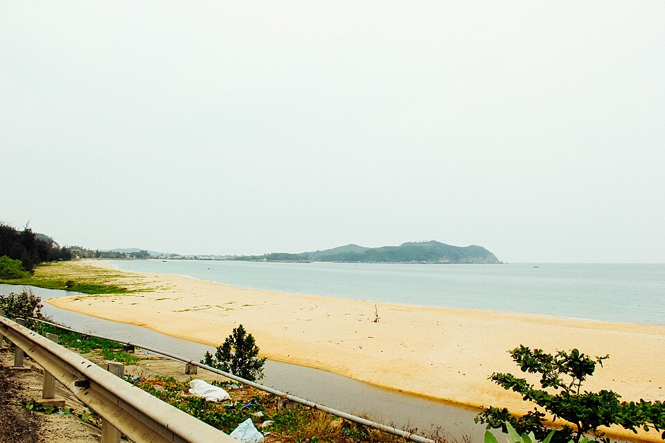
Sa Huỳnh belongs to Đức Phổ district (former Quảng Ngãi), located on the border between former Quảng Ngãi and former Bình Định. This is where French archaeologists discovered the Sa Huỳnh culture in 1909 — a 3,000-year-old civilization (1,000 BCE – 200 CE) with characteristic jar burials, glass jewelry, and iron artifacts — the precursor to the Champa kingdom. The Sa Huỳnh Culture Museum displays original artifacts in the town. Sa Huỳnh beach is 3 km long with golden sand, moderate waves, and is still very pristine — with far fewer tourists than Quy Nhơn. The area is also famous for its artisanal Sa Huỳnh salt production — the vast white salt fields under the sun are very impressive. Nearby is An Khê lagoon — the largest freshwater lagoon in Quảng Ngãi, where migratory birds are most abundant in Central Vietnam.
Things to do:Măng Đen is a town in Kon Plông district (former Kon Tum, now part of Gia Lai), located at an altitude of 1,200 m on the Kon Plông plateau. The climate is cool year-round at 18 – 22°C — similar to Đà Lạt but much more pristine and not yet commercialized. The area, over 100 km², is covered by hundreds of years old pristine pine forests, 7 natural lakes (hồ Đắk Ke, hồ Toong Đam, hồ Toong Zorh...) and a system of beautiful waterfalls (thác Pa Sỹ, thác Đắk Ke). Măng Đen is being planned as a national eco-tourism area — but currently remains a mysterious, little-known destination. Around Măng Đen are the villages of the Xê Đăng and Mơ Nâm ethnic minorities with traditional communal houses and the most authentic gong culture in the Central Highlands.
Things to do: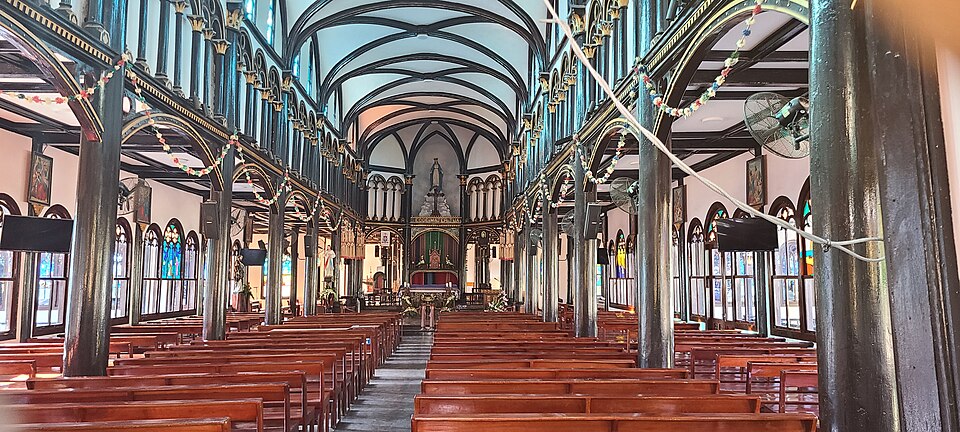
Kon Tum Wooden Church (Kon Tum Cathedral) is located right in the center of Kon Tum city, 200 m from the Đắk Bla River. It was designed and built by a French priest in 1913 entirely from cà chít wood (a type of wood endemic to the Central Highlands) — without using iron nails, only wooden tenons. The architecture combines French Gothic (stained glass windows, pointed roof) with Ba Na communal house (high wooden floor, steep thatched roof) — creating a unique architectural style in Vietnam. Inside the church, there is a wooden ceiling carved with Central Highlands patterns, a wooden altar, and statues of Saints made of precious wood. Next to the church is the Ba Na Culture Exhibition House (former orphanage) displaying gongs, miniature communal houses, and artifacts of the local people's daily life. The church still operates normally for religious activities, and tourists can visit for free outside of mass hours.
Things to do: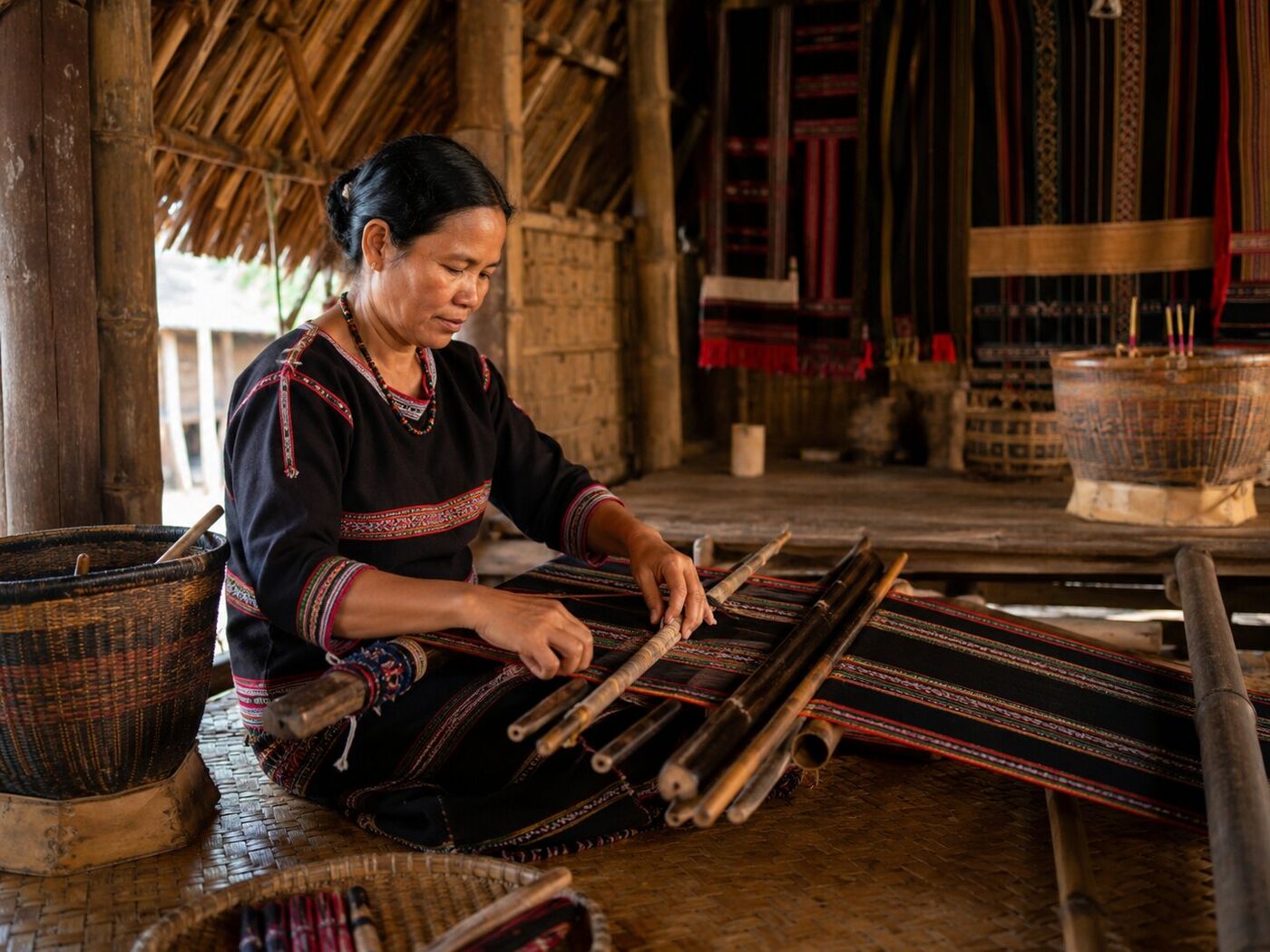
Around Kon Tum city, there is a system of Ba Na and Xê Đăng ethnic minority villages along the Đắk Bla River — notably Kon K'tu village, Kon Jơ Dri village, Plei Tơ Nghĩa village. These villages still preserve intact communal houses — the symbolic architecture of the Central Highlands, with high thatched roofs 15 – 20 m, serving as community gathering places, for playing gongs, and telling epics. In 2005, the Space of Gong Culture in the Central Highlands was recognized by UNESCO as a Masterpiece of the Oral and Intangible Heritage of Humanity — gongs are the language of communication with the spirits, accompanying all rituals from birth to death. In these villages, Ba Na women still weave brocade using traditional backstrap looms — with characteristic geometric patterns. Tourists can stay in homestays in the villages, participate in brocade weaving, drink rượu cần around the communal house's fire, and listen to village elders tell epics.
Things to do: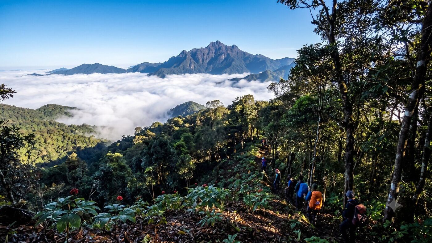
Ngọc Linh peak, 2,598 m high, belongs to the Trường Sơn mountain range, located at the border of Đắk Glei and Tu Mơ Rông districts (former Kon Tum, now belonging to Gia Lai). This is the highest mountain peak in the Central Highlands and the 4th highest in Vietnam (after Fansipan, Putaleng, Phu Si Lung). Ngọc Linh is most famous for Ngọc Linh ginseng (Panax vietnamensis) — a rare ginseng species that only grows at an altitude of 1,200 – 2,400 m on Ngọc Linh mountain, and has been studied to have a higher saponin content than Korean ginseng. The price of natural Ngọc Linh ginseng is 80 – 300 million VND/kg, cultivated ginseng is 30 – 80 million VND/kg. Trekking to Ngọc Linh peak takes 3 days and 2 nights, starting from Tu Mơ Rông — passing through primeval forests covered with moss, springs, and ginseng gardens on the mountainside. Ngọc Linh is also the meeting point of three regions: Vietnam – Laos – Cambodia (the conventional Indochina tripoint).
Things to do:High-speed boat from Sa Kỳ port (former Quảng Ngãi) to đảo Lớn takes about 30 minutes, with many trips per day. From Quy Nhơn to Sa Kỳ is about 170 km by car (3h), then 30 minutes by boat.
Approximately 300 km. 45-minute flight (Đà Nẵng – Phù Cát). Approximately 5 – 6 hours by car on National Route 1A. Approximately 5 hours by train.