Tây Ninh Province
The 'roof of the South' and the gateway to Đồng Tháp Mười
Southern Vietnam · Southeast Region – Mekong Delta
The 'roof of the South' and the gateway to Đồng Tháp Mười
Southern Vietnam · Southeast Region – Mekong Delta
The new Tỉnh Tây Ninh was formed by the merger of two provinces, Tây Ninh and Long An, according to Resolution 202/2025/QH15, officially operating from July 1, 2025. With an area of 8,536.44 km² and a population of 3,254,170 people, the new province combines two completely different topographies: the Northwest is the former Tây Ninh area with Núi Bà Đen — the 'roof of the South' — and Toà Thánh Cao Đài; the Southeast is the former Long An with Đồng Tháp Mười, melaleuca forests, and intricate canals of the Mekong Delta. The administrative center is located in thành phố Tân An — a geographical location close to TP. Hồ Chí Minh, convenient for administering the new province. The Tây Ninh region borders Cambodia, and was once an important revolutionary base with 'R' — the headquarters of the Central Office for South Vietnam.
Núi Bà Đen, 986 m above sea level — the highest mountain in the Southern Region, known as the 'roof of the South'. Located about 8 km from Tây Ninh city center and about 100 km from Ho Chi Minh City, the mountain consists of three peaks: núi Bà Đen, núi Heo, and núi Phụng, with a total area of about 24 km². This is one of the most important pilgrimage sites in the South, associated with the legend of Bà Đen Lý Thị Thiên Hương. At the summit, the Sun World cable car system takes visitors up in 8–10 minutes — below is a panoramic view of hồ Dầu Tiếng and the Southern Delta stretching to the horizon.
Things to do: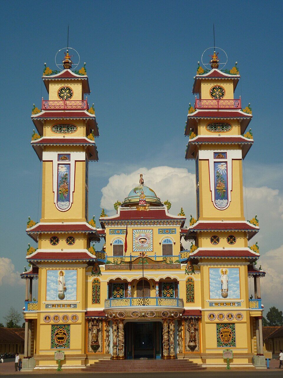
Tòa Thánh Tây Ninh is the largest religious center of Caodaism — an indigenous Vietnamese religion founded in 1926, harmonizing the essence of Buddhism, Catholicism, Taoism, and Confucianism. Constructed from 1933 to 1955, its architecture blends East and West: an East Asian yin-yang tiled roof combined with Western Corinthian columns, and a 'Thiên Nhãn' (Divine Eye) — the sacred eye symbolizing Caodaism — on the main facade. Visitors can attend daily religious ceremonies at 6 AM, 12 PM, 6 PM, and 12 AM — with numerous white-clad followers praying in a vibrant, colorful space.
Things to do:
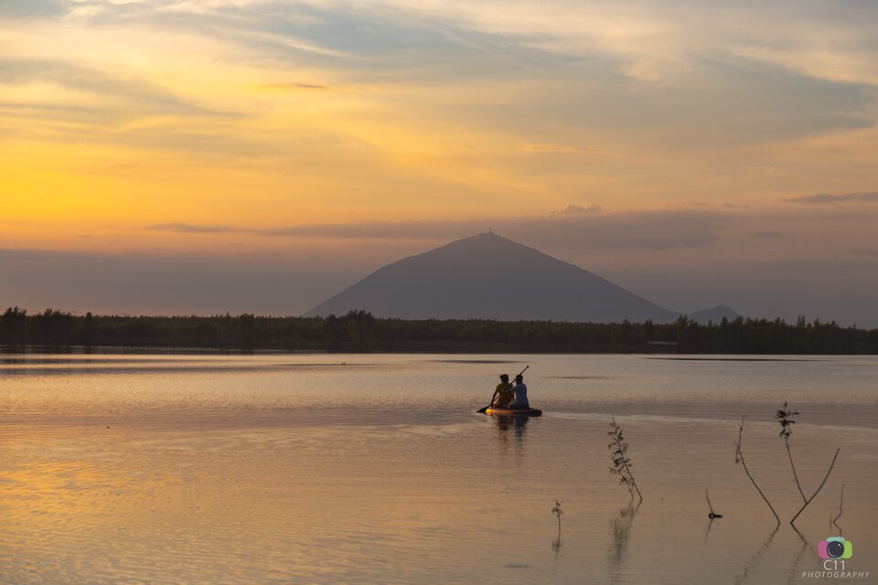
Hồ Dầu Tiếng is Vietnam's largest artificial irrigation lake and one of the largest artificial lakes in Southeast Asia, with a surface area of approximately 270 km² and a capacity of 1.58 billion m³. The lake stretches across Tây Ninh, former Bình Phước (now part of Đồng Nai), and Ho Chi Minh City. Surrounding the lake are rubber forests and rice fields; there are many small islands on the lake — among which đảo Nhím is the most famous for its pristine landscape, a popular weekend camping spot for Saigonese. Sunset on Hồ Dầu Tiếng is one of the most memorable beautiful sights in the South.
Things to do: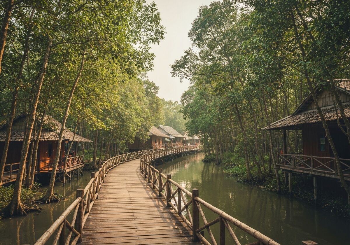
Tân Lập Floating Village, located in Mộc Hoá district, former Long An region (now part of Tây Ninh province), is one of the most unique ecological areas in Đồng Tháp Mười. Spanning approximately 600 ha of melaleuca forest wetlands, visitors can take a boat through melaleuca trees 20–30 m tall, observing birds, storks, fruit bats, and the characteristic swamp ecosystem of the Mekong Delta. Notably, a more than 5 km concrete walking path through the melaleuca forest allows visitors to delve deep into the forest — an experience of the 'dense southern forest' that is very different from forest areas in the North.
Things to do: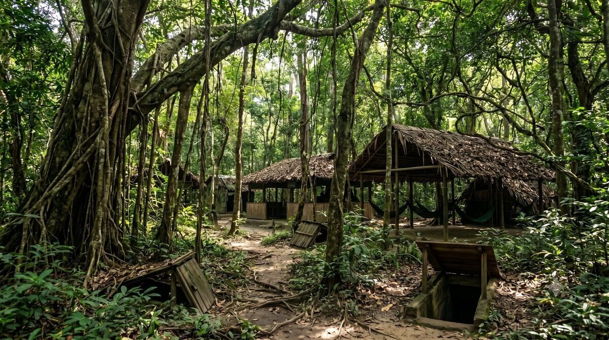
The Central Office for South Vietnam (code name 'R') base, located in Tân Lập commune, former Tân Biên region, was the headquarters directing the revolution in South Vietnam during the 1961–1975 period. Hidden in the old forest bordering Cambodia, the base comprised a system of tunnels and camps built and meticulously camouflaged — where many high-ranking leaders such as Nguyễn Văn Linh, Võ Văn Kiệt, and Phạm Hùng lived and worked. After liberation, the historical site was restored and became a traditional education destination. The path into the base through the forest remains pristine — giving a feeling of traveling back in time to the war era.
Things to do:Tây Ninh province has just merged Tây Ninh and Long An under Resolution 202/2025/QH15, effective July 1, 2025. Its area is 8,536.44 km², with a population of 3,254,170 people, and the administrative center is located in Tân An city (former Long An).
Tân An (former Long An) has a geographical location close to Ho Chi Minh City, a large population, and developed infrastructure — favorable for administering the new, larger province.
Still part of Tây Ninh. The merger only added Long An, it did not change any tourist attractions in the former Tây Ninh area.
Yes. The two locations are only about 9 km apart. Take the cable car up the mountain in the morning, have lunch in Tây Ninh city, visit Toà Thánh in the afternoon — and return to Ho Chi Minh City in the evening.
License plate prefixes 70 (former Tây Ninh) and 62 (former Long An); phone area codes 0276 and 0272. Documents issued before July 1, 2025, remain valid.
Tân Lập Floating Village in Đồng Tháp Mười, Bến Lức fruit orchards, and Long An ancient houses. The Long An area features the characteristics of the Mekong Delta's riverine region — complementing the former Tây Ninh area, which is more mountainous and borders.