Tuyên Quang Province
The northernmost region — stone plateau and resistance capital
Northern Vietnam · Northern Midlands and Mountainous region
The northernmost region — stone plateau and resistance capital
Northern Vietnam · Northern Midlands and Mountainous region
The new Tuyên Quang province was formed by the merger of Tuyên Quang and Hà Giang provinces according to Resolution 202/2025/QH15, officially operating from July 1, 2025. With an area of 13,795.6 km² (ranked 7th nationwide) and a population of nearly 1.9 million people, this is one of the most culturally rich and historically significant regions in Vietnam: to the north is the Đồng Văn Stone Plateau — a UNESCO Global Geopark — with Mã Pí Lèng, Lũng Cú, the northernmost national landmark; to the south is the Tân Trào war zone, once the 'Resistance Capital' of the Vietnamese revolution from 1945–1954. The administrative center is located in thành phố Tuyên Quang. More than 20 ethnic groups live here, leaving behind a vibrant culture from the Hmong market fairs on the stone plateau to the Tày and Dao villages around Na Hang lake.
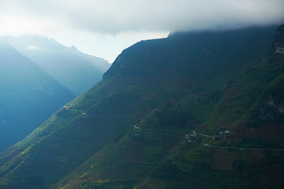
Mã Pí Lèng is known as the 'king' of the four great mountain passes in Northern Vietnam. Approximately 20 km long on National Road 4C connecting Đồng Văn town with Mèo Vạc town, the pass winds over the peak of Mã Pí Lèng mountain, about 1,200 m high, belonging to the Đồng Văn Stone Plateau. The road was built by tens of thousands of youth volunteers over six years (1959–1965), with the section crossing the pass requiring them to hang on the cliff face for 11 months — hence it is also called 'Happiness Road'. Standing at the panorama viewpoint looking down, the Nho Quế River appears like an emerald thread winding through the deep Tu Sản canyon — a majestic landscape considered one of the best in Vietnam.
Things to do: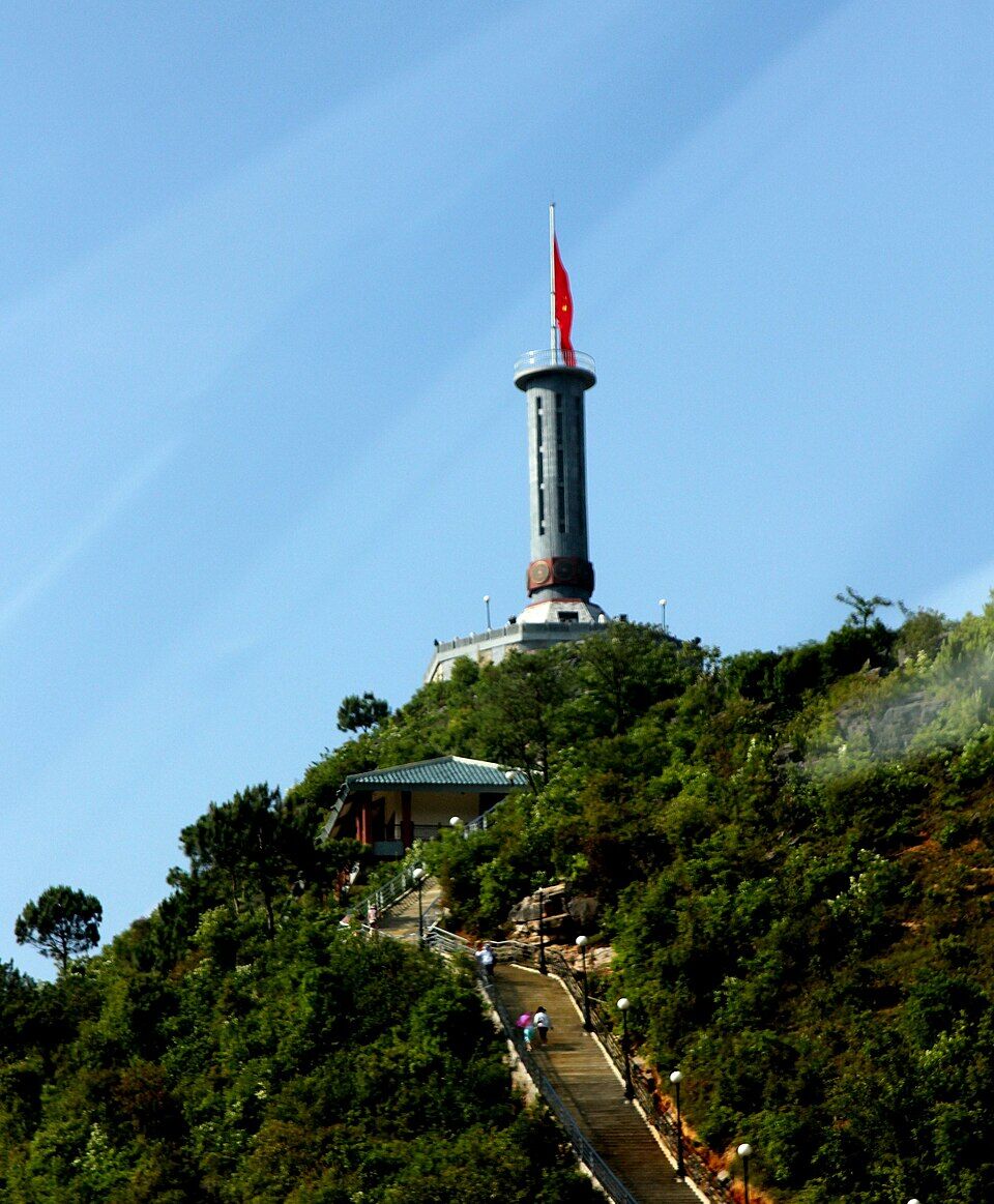
Lũng Cú Flagpole is a sacred symbol of the northernmost region of Vietnam, erected on Rồng mountain peak at an altitude of about 1,470 m above sea level. The national flag, 54 m² in size, flies proudly, symbolizing the 54 ethnic groups. To reach the base of the flagpole, visitors climb about 839 stone steps, then continue up a spiral staircase inside the pole — the reward is a 360° view down to the Hmong and Lô Lô villages nestled in the stone valley. Standing here, you are truly at the 'top' of the country.
Things to do: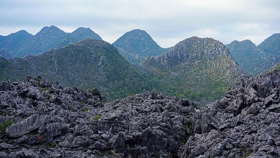
Đồng Văn Stone Plateau is a limestone plateau located at an altitude of 1,000–1,600 m, stretching across the four former districts of Quản Bạ – Yên Minh – Đồng Văn – Mèo Vạc of Hà Giang. In 2010, UNESCO recognized it as a Global Geopark — Vietnam's first such title. The landscape of towering cat-ear rocks, narrow valleys, steep passes, and Hmong villages perched on rocky slopes creates a land unlike any other in Vietnam. In autumn, buckwheat flowers bloom in pinkish-purple, covering the hillsides — the time when the stone plateau is at its most beautiful.
Things to do: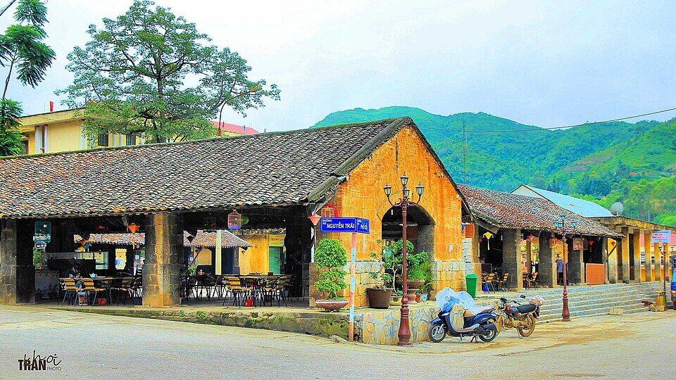
Located in the heart of Đồng Văn town at an altitude of over 1,000 m, Đồng Văn Old Quarter is a complex of about 40 ancient houses over 100 years old, bearing the architectural imprints of the Hmong, Chinese, and French. With moss-covered yin-yang tiled roofs, rammed earth walls, and smoke-stained wooden columns — the old quarter is most beautiful in the early morning when fog covers it and in the evening when red lanterns are lit. The Đồng Văn market, held on Sunday mornings, is the 'soul' of the quarter: Hmong, Lô Lô, and Dao people come to the market in traditional costumes, buying and selling, eating thắng cố, and drinking corn wine.
Things to do: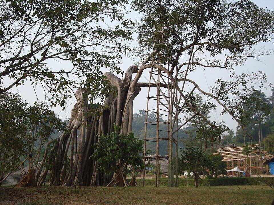
The Tân Trào historical relic site, located in Tân Trào commune, former Sơn Dương area, is where President Hồ Chí Minh and the Party Central Committee lived and worked during the pre-insurrection months of 1945 and throughout the First Indochina War 1945–1954 — hence it is called 'Capital of the Liberated Zone', 'Resistance Capital'. The complex consists of 177 large and small relics spread across 12 communes in the former Sơn Dương – Yên Sơn area, among which the most famous are the Tân Trào banyan tree (nearly 300 years old), Nà Nưa shack, Tân Trào communal house, and Hồng Thái communal house. In addition to its historical value, Tân Trào is also a pristine hilly area with a community-based tourism model in Tân Lập village.
Things to do:The new Tuyên Quang province was merged from Tuyên Quang and Hà Giang provinces according to Resolution 202/2025/QH15, effective from 01/7/2025.
In Tuyên Quang city – the former center of Tuyên Quang province. The new province has an area of 13,795.6 km² (ranking 7th nationwide) and a population of 1,865,270 people.
The new Tuyên Quang uses license plate prefixes 22 (former Tuyên Quang) and 23 (former Hà Giang); telephone area codes 0207 and 0219. License plates and documents issued before 01/7/2025 remain valid.
After the merger, the entire Đồng Văn Karst Plateau – including đèo Mã Pí Lèng, Cột cờ Lũng Cú, Phố cổ Đồng Văn, and sông Nho Quế – all belong to the new Tuyên Quang province.
The popular itinerary is 3 days 2 nights starting from Hà Nội: day 1 to former Hà Giang city, day 2 to Quản Bạ – Yên Minh – Đồng Văn, day 3 conquering Mã Pí Lèng and returning. Backpackers often go for 4 days for a more relaxed pace.
The former Tuyên Quang region was primeval forest, Na Hang hydroelectric lake, and revolutionary historical sites (Tân Trào). The former Hà Giang region was a karst plateau, mountain passes, and Hmong villages. After the merger, the new province has both – from forests to rocks, from history to the border.